Satellite monitoring uses Atlas InSAR which is Sixense’s innovative Radar Interferometry (InSAR) solution to measure ground deformation and structure stability from space with millimetric precision.
Based on radar satellite images, advanced processing Atlas InSAR provides millions of measurement points in areas of interest, either for construction or for maintenence activities.
Through all project stages – design, construction or operation – satellite monitoring can provide both a comprehensive map of terrain behavior over large areas as well as high resolution detailed analysis of single structures.
Atlas InSAR is a remote sensing technology which provides results without site intervention and a supportive and cost-efficient tool for risk management and optimisation of instrumentation network.
Atlas InSAR plays an increasing role in satellite monitoring and mitigating the impacts of natural and man-made sources of ground motion.
Atlas InSAR solutions
How does it work?
Radar interferometry is a Satellite remote sensing technique which is capable of measuring millimetric motion of terrain over wide areas.
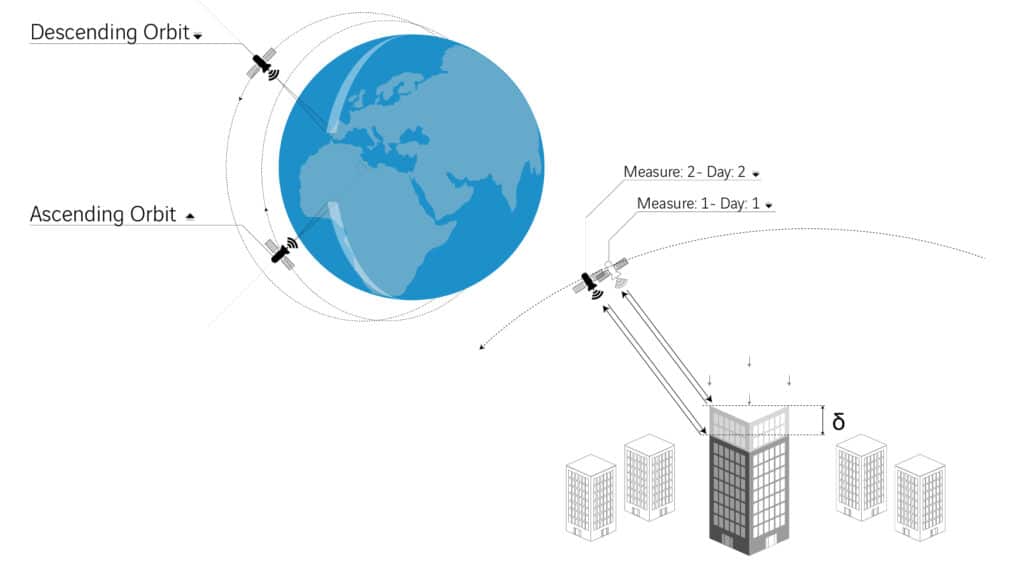
Interferometric synthetic aperture radar (InSAR) involves the use of two or more synthetic aperture radar (SAR) images of the same area in different moments of time to retreive landscape topography and associated deformation patterns.
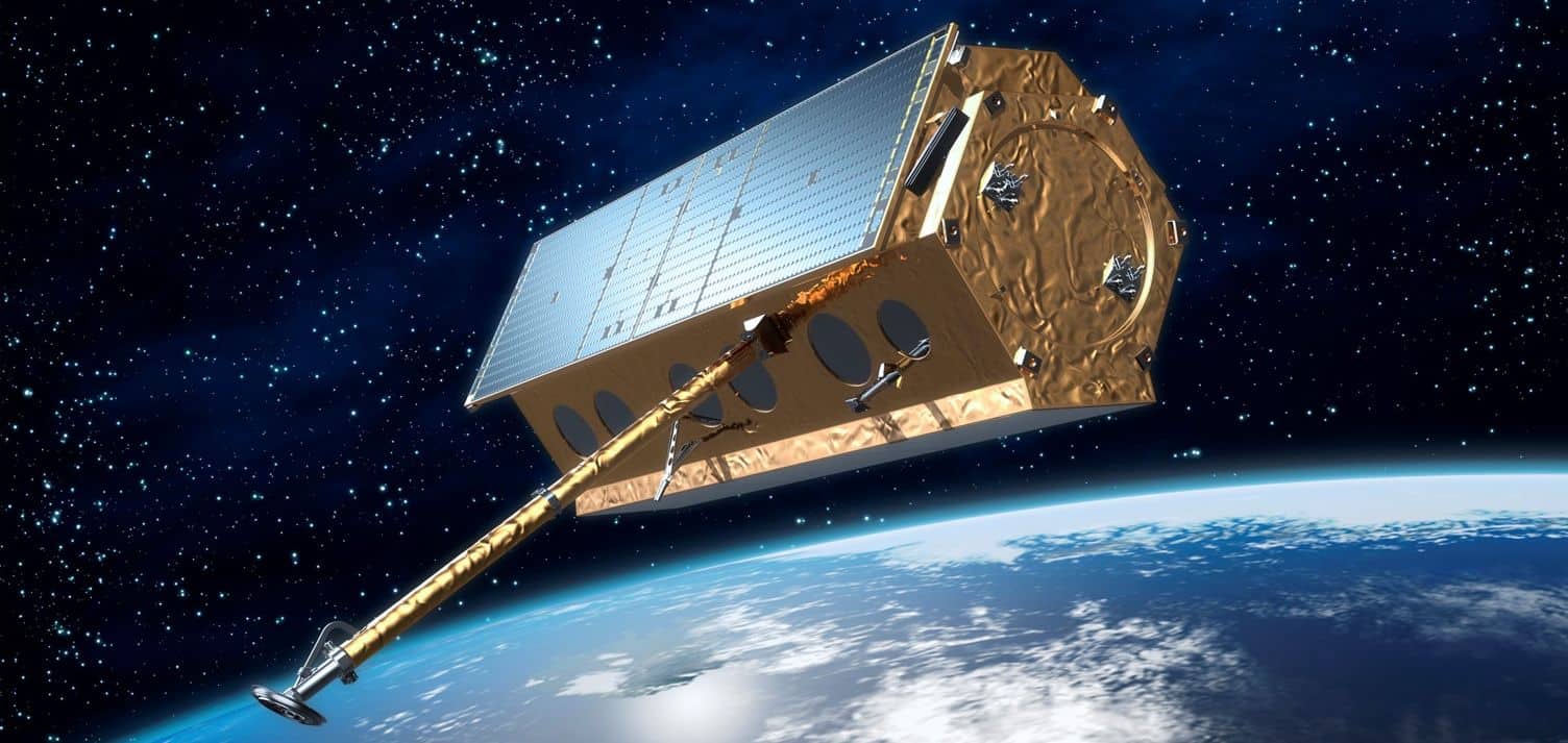
A SAR sensor transmits electromagnetic waves to the ground and collects its backscateering signal and can operate during day and night under all-weather conditions.
When several measurements are compared the difference indicates ground deformation over time.
For any ground point, satellite time series enable the follow-up of phenomena every few days during the monitoring period.
A step further to get millimetric precision
Atlas InSAR is Sixense’s Radar Interferometry (InSAR) processing chain whose aim is monitoring of geotechnical and structural deformations.
The Atlas processing chain is based on advanced PSI (Persistent Scatterer Interefometry) methodology and takes conventional InSAR a step further to achieve millimetric precision of the ground motion readings.
This technique requires an initial stack composed of more than fifteen SAR images.
The PSI algorithm identifies common points (Persistent Scatterers) in each image for which it will be possible to derive accurate measurements during the study period.
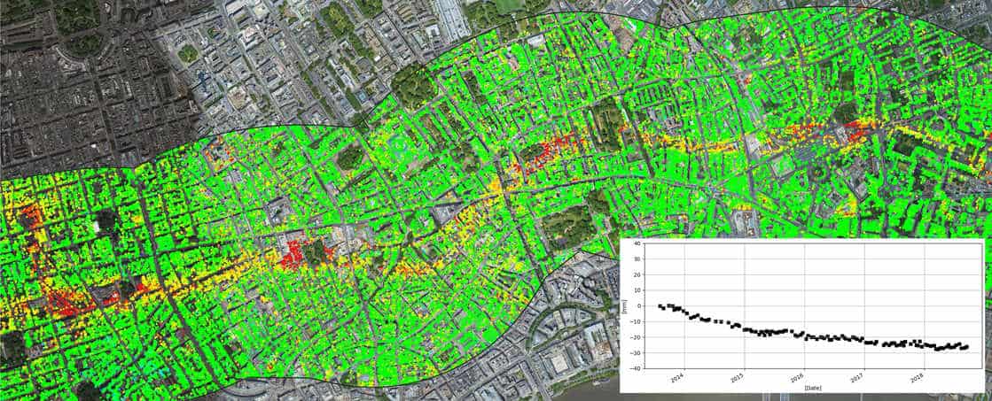
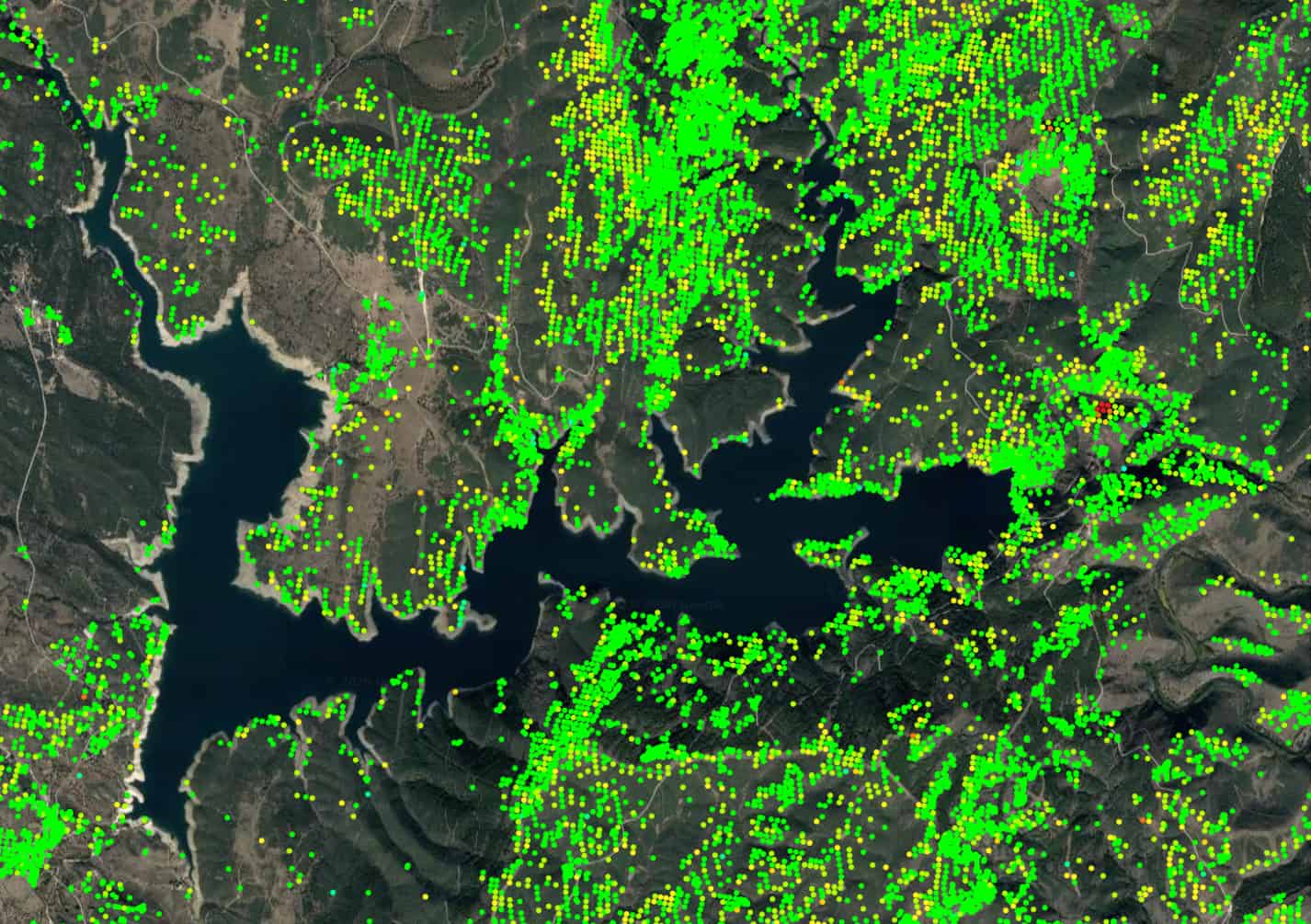
The outputs of Atlas processing are maps presenting accumulated displacement and mean velocity deformation throughout the study period for each measured point (PS).
Many relevant industry applications
ATLAS InSAR is a technology that is making industries and lives safer, practices more efficient and the understanding of our ground behaviour deeper.
ATLAS InSAR is being used in many industry applications, from monitoring the centimetric movement of slopes in mountains, to measuring with millimetric precision the displacement of bridges, buildings, viaducts, mining slopes or key infrastructure such as tailings dams.
Atlas InSAR features & benefits
- Millimetric precision: up to 1 mm/year and 2-3 mm precision on single measurement points
- High measurement frequency: 3, 6 or 12 days between acquisitions depending on satellites
- High density of measurement points: more than 20,000 sq. km in urban areas
- Coverage of large areas: monitoring over remote and very extensive areas (thousands of sq. km)
- Retrospective studies: past ground motion analysis from 1992 using archive satellite images
- Non-invasive system: remote solution without site intervention and free of maintenance
- On-demand monitoring: update frequency adjusted to magnitude of motion and project needs
- Web platform: user interface for a quick and easy interpretation of million of measurement points
The additional benefits of using the Sixense Atlas InSAR solution
- A unique competence combining InSAR data and Ground Instrumentation data
Sixense is the sole suplier offering this wide range of ground and space sensors and an integrated solution
for the civil engineering industry. Sixense has more than 700 engineers worldwide dedicated to the construction sector and holds more than 10 years of expertise processing satellite radar data . This gives us a deep understanding in the sector.
- Atlas InSAR, a high quality processing chain
Sixense is always looking for new innovative solutions bringing added value to our clients and in 2004 we started developing our own InSAR solution to provide an additional response to the complex issue of ground deformation. Atlas InSAR is in constant development to keep up with new opportunities offered by the unprecedented spatial and temporal volume of Synthetic Aperture Radar (SAR) data – this is only going to increase with new sensors in the future.
- Advanced web platform
Beyond Satellite is able to transform data into actionable information, customised according to client needs, and using cutting-edge analytic tools. Moreover, it offers the possibility to integrate in-situ monitoring measurements with Atlas results to provide clients with multiscale and holistic control for the different assets of interest.